The nature of the Saharan soil is inhospitable; however, the underground contains mining and mineral resources whose development has contributed to the improvement of living standards of local people and the region’s development.
The adoption of geospatial technologies such as Geographic Information Systems by the departments in charge of geology and mines in the Sahara region has enabled the development of a mapping aid program for optimal management of natural resources, the environment and land planning.
Based on this technology, several synthesis studies have been developed for the identification of available resources, geographic location of layers, their reach and depth, importance of reserves and mineral content.
We present below a map of mineral deposits in the Kingdom of Morocco with particular focus on the Sahara region:
We will also present geological maps of the major cities in the Sahara region.
Carte Geological map of Laayoune:
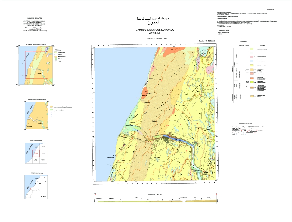
Click here to accede to advanced zoom features forward / back and return to original position. Hold down the mouse on the map and move from side to side and up and down.
Geological map of Dakhla :
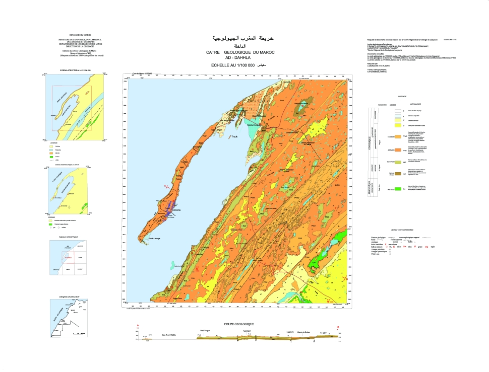
Click here to accede to advanced zoom features forward / back and return to original position. Hold down the mouse on the map and move from side to side and up and down.
Geological map of Smara:
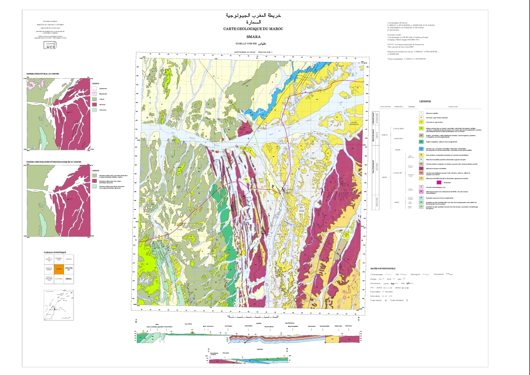
Click here to accede to advanced zoom features forward / back and return to original position. Hold down the mouse on the map and move from side to side and up and down.
Geological map of Boujdour:
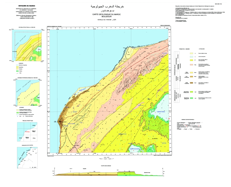
Click here to accede to advanced zoom features forward / back and return to original position. Hold down the mouse on the map and move from side to side and up and down.
Source : Ministry of Energy and Mining (2007).