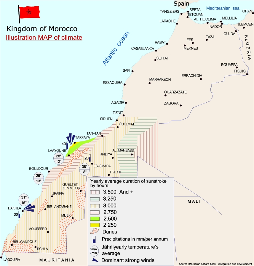
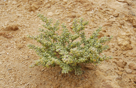
The southern region of Morocco is characterized by a dry desert climate. In addition, Moroccan weather varies according to the visited zones. If the regions close to the sea or the ocean know a moderate climate, the Saharan area undergoes a very hot climate at daytime and cold at night.
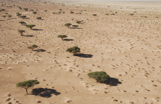
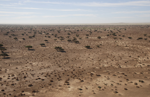
The regions of the South cover a surface of 252.120 km square and form a number of plains and plates offering great relief uniformity, contrary to the Eastern Sahara surrounded by mountainous massifs. The structure of this relief, very worn because it emerged anciently, is relatively simple. We can distinguish 3 great general tendencies North-South.
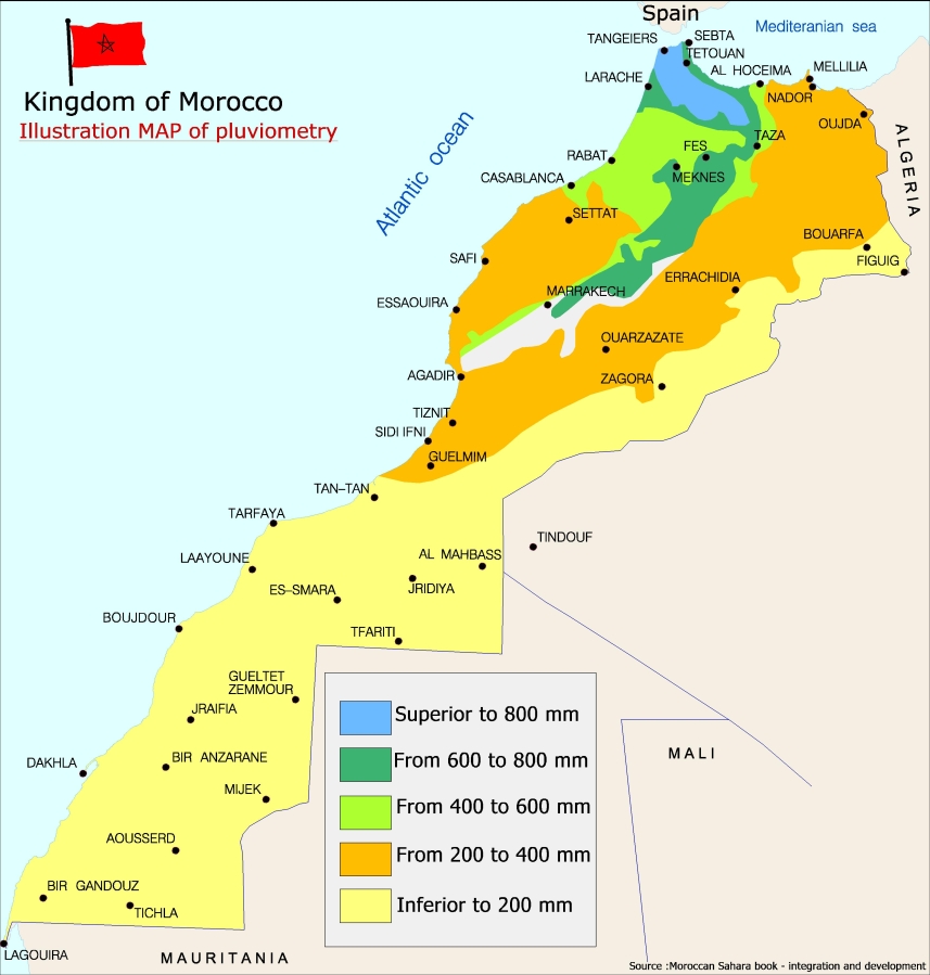
Source : livre Sahara marocain - Intégration et développement
• Reguibat dorsal, in the Eastern region, from Laguira until the South-east of the province of Smara. It is a plain made of Precambrian lands on which rock remains are accumulated. It is slightly dominated to the North by primary and cretaceous plateau covered by tertiary sediments and to the West by Gada plateau. Accidental surface waters formed closed basins or sebkhat (e.g. ldjil Sebkhat).
• the dominating the coastal plain, Gada, extends to the North until the Draâ valley and to the South until the 23rd parallel. Composed of limestones plateaus, the relief and rains cause very weak and occasional flow of wadis (rivers) whereas inside a transverse valley, Saguiat El Hamra flows almost every year. Towards the South, flow becomes increasingly rare.
• The coastal plain is made of tertiary and quaternary sediments; some isolated dunes and weak closed depressions (Sebkhat Tah) break the landscape monotony.
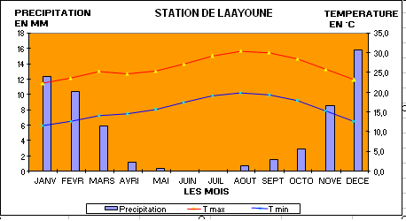
Weather data about the province of Laâyoune:
| Minimum Temperature Rate |
16°C |
| Maximum Temperature Rate |
26°C |
| Average Pluviometry |
50 mm/an |
| Wind Speed (Most violent) |
83 km/h |
|
Average Speed of Strong winds |
73 km/h |
|
Humidity Rates |
75% |
If the general orientation of the great geomorphological sets is longitudinal, it is the same for bioclimatic zones which constitute bands more or less parallel with the ocean and go from the maritime Sahara to the constantly wet atmosphere in the arid Sahara.
The climate in the Saharan provinces is characterized by very weak precipitations. The absence of significant reliefs, parallel direction with the littoral of winds, stability of atmospheric circulation are hostile to a regional recrudescence of rains.
The coast, generally rectilinear, is a succession of small sandstone cliffs and mainly of lagoons isolated by offshore strands covered with dunes arranged in wind direction. The littoral is exposed to movement apart from Dakhla and Laâyoune. Tide is of weak amplitude.

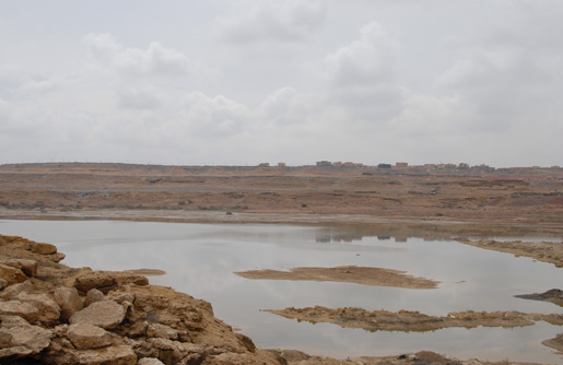
The southern region receives a weak quantity of rain: the total volume of precipitations there reaches about 11 mm of rain a year whereas in Laâyoune it reaches 40. Nevertheless, during the last years more frequent precipitations took place, which gave life to land and hope to farmers and stockbreeders who seized this happy event to extend their activities.
Meteorological data concerning Smara province.
| Minimum Temperature Rate |
15°C |
| Maximum Temperature Rate |
31°C |
| Average Pluviometry |
12 mm/year |
| Wind Speed (Most violent) |
71km/h |
| Average Speed of Strong winds |
59 km/h |
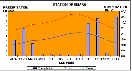
The influence of the ocean is well seen in the relative atmosphere humidity. fog and smog are frequent: Tarfaya, 24 dew days per year, 33 in Dakhla and 2 only in Smara.
Air moisture directly influences temperatures. As we move away from coasts, the annual thermal amplitude increases: it is 16° on 24 ° littoral in Smara. At sea edge, temperatures vary between 12° in January and 28° of July; 6 - 8° and 32° inside. Consequently, the Moroccan Sahara is bordered by an attenuated desert.
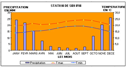
Graph source: Direction de la météo nationale